GIS technology has a long history at the Delaware Water Resource Center (DWRC) and previously at the Water Resources Agency for New Castle County, Delaware. GIS entails using digital data and computer-processing techniques to create, display, manage, and analyze spatial information.
Since the early 1970s, WRA has been at the forefront of this technology, working together since 1975 with ESRI, Inc.—the industry leader in geospatial analysis—to develop a digital, automated data management and retrieval system decades before such systems became commonplace. This early system, implemented by Vern Svatos (considered by many to be the “father of GIS” in Delaware) was groundbreaking. It ran on a large mainframe computer and used old-fashioned punch cards. That such a sophisticated system was implemented near the dawn of the computer revolution is certainly a testament to the visionary quality of DWRC personnel from the outset.
This leading position in geospatial analysis in the water resources field continues today. With its three-part mission of public service, research, and education, DWRC’s incorporation into the University of Delaware’s Institute for Public Administration (IPA) has also allowed its GIS services to expand into several new areas.

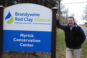
Andrew Homsey, Associate Policy Scientist
In addition to serving the needs of DWRC’s governmental funding partners, GIS is now widely used within the IPA for planning and land-use analysis, watershed management and pollution control, and advanced mapping techniques. IPA’s GIS specialists are also active in the area of the incorporation of spatial technologies in K-12 schools and teach several graduate-level classes in the Biden School of Public Policy & Administration. The scope of this work has also increased to include projects across the state and throughout the region, and GIS personnel actively present their research findings at local, regional, and national conferences.
DWRC supports and encourages the use of GIS technologies throughout the organization, the University and the wider community, and employs several graduate research assistants. Its GIS-skilled students have gone on to excellent jobs in the profession, in the private, governmental, and nonprofit sectors.

